FAQs
Frequently Asked Questions
General Questions about ECS Land Surveyors, Inc.
What types of clients does ECS Land Surveyors, Inc. work with?
How do I know which survey or service I need?
Our team is here to help guide you. Contact us with details about your project, and we can recommend the appropriate surveys or services to meet your needs, whether it’s a boundary and topographic survey for engineering or architectural design or utility mapping for infrastructure planning.
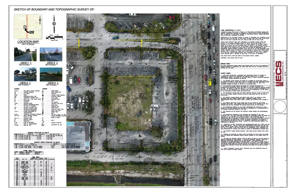
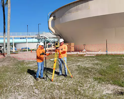
What technology do you use to ensure accuracy in your surveys?
We utilize advanced survey tools such as GPS, Base/Rover-RTK, Robotic Total Stations, Drone (UAS) technology, and specialized software to deliver precise and reliable results on every project. This ensures you receive the most accurate data for your planning and decision-making.
Can you manage large scale projects?
Yes, our services extend to all types of properties, including urban developments, subdivisions, shopping centers, and large-scale industrial sites.
Questions About Specialized Services
How does Utility Mapping services prevent potential project delays?
Utility Mapping allows the location and identification of underground utilities before excavation begins, reducing the risk of accidental damage and delays caused by utility repairs or compliance issues.
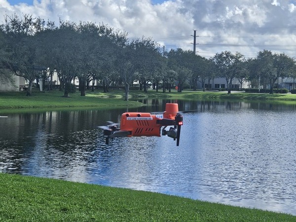
Are drone (UAS) operations safe and compliant with regulations?
Absolutely. Our certified drone operators adhere to all FAA guidelines and regulations, ensuring safe operations while capturing high-resolution imagery and survey data for your project.
Can your services support environmental compliance, such as for parks or beach restoration?
Questions About Land Development
What’s involved in your Subdivision Platting & Construction Layout services?
This service includes everything from creating detailed subdivision plat maps to staking roads, utilities, and lot boundaries. We ensure that every stage meets engineering standards and municipal regulations for a seamless development process.
Working with ECS Land Surveyors, Inc.
How long does it take to complete a survey?
How can I get started with your services?
Getting started is easy! Contact us via phone or Click Here to fill out our form to discuss your project needs. Our team will gather preliminary details and provide recommendations tailored to your requirements.