get a quote now!
Submit your information and we’ll reach out to schedule your consultation

Leveraging Cutting-Edge Technology for Precise Drone Mapping and Surveying Solutions
At ECS Land Surveyors, Inc., we integrate advanced technology into our services to deliver unparalleled accuracy and efficiency. From utility mapping to drone operations, our innovative solutions are designed to meet modern surveying challenges with precision. Explore our advanced services below!
Advanced Technology Services
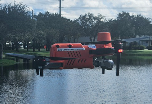
UAS/Drone Operations
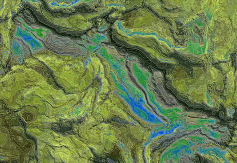
Harness the power of UAS (Unmanned Aerial Systems) and drone mapping and surveying to access data that was once out of reach. Our FAA licensed drone operators utilize high-resolution imaging to conduct surveys for large areas and hard-to-reach locations with incredible efficiency.
- High-resolution aerial imagery for large-scale mapping
- Detailed topographic and surface analysis
- Safe and efficient data collection in inaccessible areas
- Ideal for construction, land development, and environmental studies
Advanced Technology Services
Interior Survey
- Measurement of walls, floors, and interior spaces
- 3D data capture for architectural and design purposes
- Support for renovation planning and space optimization
- Accurate documentation for compliance with building standards
Partner with ECS Land Surveyors, Inc. for Advanced Surveying Solutions
Testimonial
What Our Clients Say
— Sarah M., Property Developer
Their use of advanced technology saved us time and provided an incredible level of accuracy. Highly recommend!
— James R., Civil Engineer
ECS Land Surveyors consistently delivers work of the highest quality. Their reliability and ability to meet tight deadlines make them a partner we trust for every project.
— Linda K., Project Manager